The East Lakeshore Trail History and Purpose at Tellico Lake

WATERFRONT RETIREMENT COMMUNITIES WITH HIKING AMENITIES
On December 1, 2014, a group of 20 volunteer trail builders completed the last few hundred yards of the of the East Lakeshore Trail, marking a 12+ year effort, building more than 30 miles of completed trail. The initial trail building outings in 2003 were the result of meetings that started the previous year in reaction to the loss of beautiful forested land between Baker Hollow and Powerline Cove.
Meetings of a small group of citizens from Greenback and Tellico Village evolved into the Watershed Association of the Tellico Reservoir (WATeR). This organization pursued development of the East Lakeshore Trail as a major community recreational asset, but another impetus was to help deter the possibility of future sale and destruction of more lands along Tellico Lake for the purpose of additional commercial and residential development. After the Tellico Women’s Club donated some funds to purchase tools for building the Trail, a village hiking group gave-up one of their weekly hikes each month to help build the Trail. Two members of that group went down to Soddy Daisy to learn how to trail-build from the Cumberland Trail Group.
When the tools arrived, construction started. Trail work began near an old dead oak tree (it fell into the water in 2012) which the young people used for swinging out and dropping into the water. This tree was located east across the lake from the historic Bowman House in the Tanasi Neighborhood. Trail work proceeded northward following the shoreline and then east back into Powerline Cove. It took 3 years, working one morning a month, to finish this first section. In the very beginning, there would typically be 5 or 6 people out to work. Then, very slowly, other people started to arrive and contribute their time and sweat. This first section has 3 to 4 miles of trail, two bridges, one stair step, and a stone filled cage boat landing. Over the past seven years, Bob Martin, Chairman of the Trails Committee for WATeR, has been in charge organizing the trice monthly, half day work sessions that have now brought the Trail to where it is today.
Trail Purpose
The purpose of the East Lakeshore Trail at Tellico Reservoir project is to provide a recreational and educational hiking trail along a portion of the east shoreline of Tellico Lake. In 2012, the trail was recognized as a National Recreation Trail by the U.S. Department of the Interior. The East Lakeshore Trail is one of the longest National Recreation Trails in Tennessee. Hiking clubs, nature groups, and many individuals come from nearby communities to use and enjoy the trail year-round. For the past three years, in June, nearly 100 members of the Knoxville Track Club hold a race on the trail and will return again this June. The East Lakeshore Trail adds another dimension to the multi-use nature of the public land on which it is being built. It provides a quality recreational resource contributing to the physical and emotional well-being of those who use it. The trail provides an educational tool through the use of information bulletin boards at trailhead kiosks, signing of native trees and plants along the trail, and a 1.6 mile self-guided interpretive trail.
Project Description:
Construction of the East Lakeshore Trail is a joint venture between WATeR* and the Tennessee Valley Authority. It is being built mainly with volunteer labor. The concept began in 2002 and was solidified with a formal cooperative agreement between WATeR and TVA in 2003. Now it is a reality with completion of 30+ miles of trail. It is envisioned that the trail system could ultimately consist of about 35 miles with the addition of loops and spurs to scenic over looks. The project involves initial trail layout, trail construction including installation of bridges, water bars, fence stiles and timber stair treads as needed, development of trailhead parking areas with kiosk bulletin boards, scenic view areas with benches, and boat landing areas making the trail accessible by water.
The TVA provides general oversight and technical support, assisting with heavy equipment construction needs such as building trailhead parking areas and large bridges, and furnishes some of the materials needed for trail construction. The trail project is widely supported by residents of nearby local communities including Lenoir City, Loudon, Vonore, Greenback, and the general Knoxville metropolitan area. It has received support and financial assistance from the Tellico Village Women's Club, Kiwanis Club of Tellico Village, Cooper Homes, Tellico Village Woodworkers Club, Tennessee Trails Association, Tennessee Parks and Greenways Foundation, American Hiking Society, and the State of Tennessee. One of the most significant contributions to the Trail was the matching grant given to the TVA from the Tennessee Department of Environment and Conservation through the Recreational Trails Program. The grant and matching funds were applied toward the construction of an 85’ bridge that linked the Davis Ferry, Glendale, and Coyetee Loop Branches to the Sinking Creek Branch and all other parts to the south.
Currently, the East Lakeshore Trail consists of nine completed segments available for public use and enjoyment (over 30 miles).
From north to south they are:
-the Canal Branch (1.5 miles)
-the Baker Hollow Branch (3.2 miles)-the Davis Ferry Branch (3.3 miles),
- the Glendale Branch (2.8 miles),- the Coytee Loop Branch (2.4 miles),- the Sinking Creek Branch (4.5 miles),- the Lotterdale branch (3.8 miles)- the Jackson Bend Branch (5.1 miles),
- the Morganton Branch (3.1 miles).
In addition, a loop trail, a shortcut and a connector trail have been built adding more than 2 more miles to the Trail.
Location:
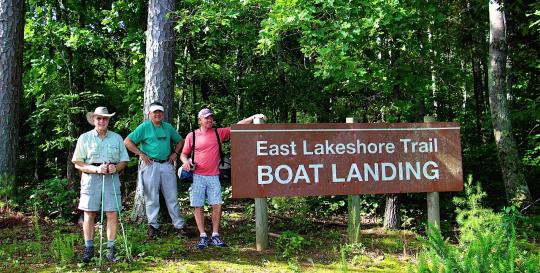
East Lakeshore Trail is located along the east shoreline of Tellico Lake opposite Tellico Village and Rarity Bay, both waterfront retirement communities. The trail lies between the Canal Bridge on Rt. 321 and mile 18 of the Little Tennessee River channel. Access to the trail is provided at six existing trailheads with vehicle parking for 15 to 20 vehicles. Two more trailheads are planned to go online in 2015. Each trailhead has an information bulletin board kiosk with a large map of the trail. Smaller take-along maps and WATeR brochures are also supplied. Three signed boat-landing areas provide easy access to the trail for boaters.
Detailed information with maps, interpretive guides, and directions to the trailheads is available on the East Lakeshore Trail menu item of the WATeR website (www. tellicowater.org).
Volunteer Info:
Work on the East Lakeshore Trail is performed 3 days a month: the first Monday, the second Tuesday and the third Wednesday. Those wanting to volunteer their time to a worthwhile community project can call Mel Fisher 865-657-9062 or email at melfisher31 @gmail.com.
Another important aspect of the trail system is the Adopt a Trail maintenance program. Volunteers are assigned to specific trail sections and are responsible for maintaining their sections on a monthly basis. Those interested in adopting a section of the trail for routine maintenance contact Lou Livengood, lou.livengood @charter.net.
On average volunteers contribute 1,200 to 1,600 hours annually to build the trail. Many more hours are contributed for planning, administrative and general maintenance needs. In 2012 there where forty-five days of trail work resulting in construction of three miles of trail from Peterson Road to Wildcat Pointe Trailhead - the Morganton Branch. Timber treads, steps, two bridges, signs, mile markers, trail blazes, and a lot of “pug” surfacing was part of the job completed. Trail builders logged 1,606 volunteer hours of trail construction averaging about nine (9) trail-builders per outing. The excellent turnout of trail-builders is what made it possible to bring the East Lakeshore Trail to Wildcat Point Trailhead, its southern terminus. Twenty-nine (29) different people participated in trail building in 2012. In addition to this, many people spent numerous hours working throughout the year to keep the entire East Lakeshore Trail in good condition. Trail building for 2012 ended on a beautiful mild December day where a member of Channel 3 TV in Tellico Village joined the trail builders to do a video documentation of the East Lakeshore Trail for a future airing of a 30-minute special on the project over the past ten years.
Description of Each Branch of Trail
Davis Ferry Branch:
The Davis Ferry Branch extends north from the Glendale Trailhead for 3.3 miles. The first two (2) miles from the Glendale parking lot go to the WindRiver Golf Course. Following the signs across the Course for less than 400 yards, the trail continues along Antioch Church Road for 1.2 miles to the end of the road where the planned parking lot and trail head will be built.
Glendale Branch:
The Glendale Branch extends south from the Glendale Trailhead to an intersection with the Coytee Loop interpretive trail. This trail is 3.0 miles via Power Point and 2.2 miles via the Shortcut. From the Glendale Trailhead to Power Point is 1.2 miles. The Power line Point Loop interpretive trail is 2.2 miles and goes from the trailhead to Powerline Point and returns via the Glendale Shortcut.
Glendale Shortcut Trail:
The Glendale Shortcut allows hikers to walk a 2.2 mile loop around Powerline Point and return to the Glendale Trailhead.
Coytee Loop Branch:
The Coytee Loop Branch extends north from the Coytee Trailhead 2.4 miles and includes a 1.6 mile self-guided interpretive loop trail. It incorporates eight learning sites marked by lettered posts along the trail.
Sinking Creek Branch:
The Sinking Creek Branch extends south from Coytee Trailhead 4.5 miles to Sinking Creek Trailhead. It features several bridges including an 85 foot steel & concrete bridge erected by TVA in 2011, and elevated 15 feet above Coytee Cove adjacent to the Coytee Trailhead.
Lotterdale Branch:
The Lotterdale Branch extends south from the Sinking Creek Trailhead 3.8 miles to the entrance road into Lotterdale Campground. Parts of the trail traverse along East Coast Tellico Parkway.
Jackson Bend Branch:
The Jackson Bend Branch extends south from the Lotterdale Campground entrance road five (5) miles to the Peterson Rd Trailhead. This branch showcases a variety of landscapes and scenic views and includes an elevation gain of more than 200 feet. A 1/4 mile connecting trail to a map kiosk at the campground entrance provides ready access to the East Lakeshore Trail for campers. The elevation on the trail at the top of the ridge is about 1,080 which means that one is about 267 feet above the summer lake level at that point.
Morganton Branch
The Morganton Branch is three (3) miles in length from Wildcat Pointe Trailhead to the soon to be built Peterson Road Trailhead. It features scenic views along the Baker Creek arm of Tellcio Lake, and will be a favorite for winter hiking with views from the Wildcat Point Ridge area. It is a 11.9 mile hike from Sinking Creek Trailhead to Wildcat Pointe Trailhead using the Lotterdale Branch, Jackson Bend Branch and Morganton Branch.
The Future
*(The Watershed Association of the Tellico Reservoir (WATeR), a 501(c)3 corporation, supports policies and projects that protect and improve the environment in and around Tellico Reservoir. The association is non-profit and non-partisan. The focus is on issues, policies, and practices that promote clean air, water, and natural habitat so that humans can live, work, and play in harmony with native plants and animals as well as with each other. The association strives to work cooperatively with governmental agencies and private organizations with similar goals and responsibilities for environmental protection and appropriate quality economic growth. Public education and demonstration projects are emphasized to make people aware of environmentally friendly practices that affect the watershed. WATeR strives to involve all stakeholders and to represent everyone interested in preserving and enhancing the environmental quality of the Tellico Reservoir Watershed.)
For folks searching for waterfront retirement communities in Eastern Tennessee, it's hard to beat living across from the East Lakeshore Trail. Ask us to send you Discovery Package information so you can experience the lifestyle up close.


